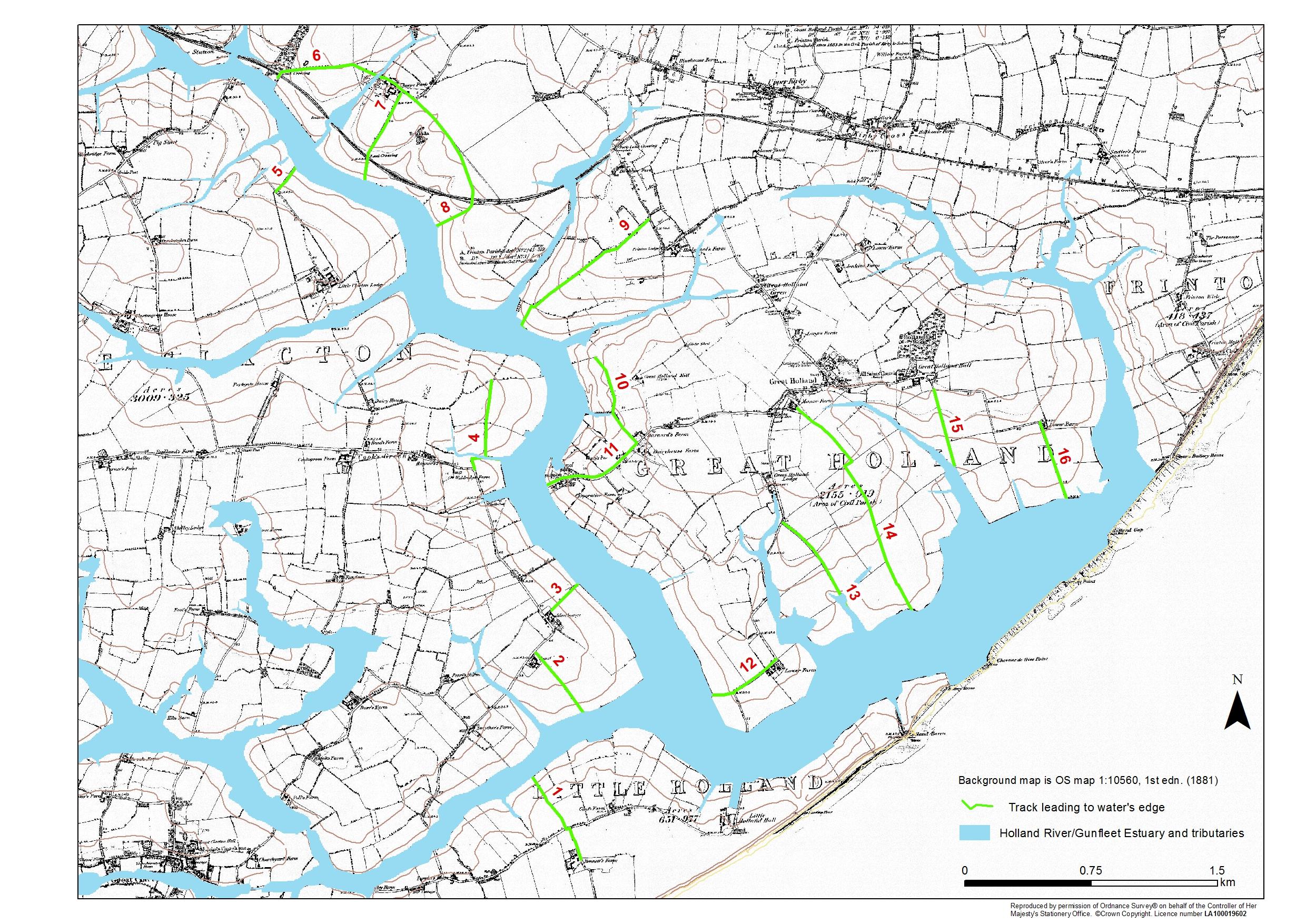
Possible landing places on the Gunfleet Estuary (map)
Period:
Medieval (AD410-1485), Early Modern (1485-1750), Hanoverian (1714-1837), Victorian (1837-1901), 20th Century (1901-1999)Copyright:
University of London / Clacton VCH GroupImage Caption:
Trackways to the possible location of former wharves and 'ladings' along the edge of the former Gunfleet estuary and Holland River as identified from maps and fieldwork.