Map showing the prebendal enclosures at Gnosall
One particularly interesting feature of the local landscape is the road pattern at Audmore. The correlation between the route-ways and the geological boundary is striking (see map). The fact that Audmore is linked to Gnosall by two parallel roads and that a large piece of land at Audmore is entirely enclosed by a road suggests that this area was of significant importance to Gnosall during its early history. It is only possible to speculate on the reasons for this arrangement, but the fact that the roads respect the integrity of the enclosed land suggests that it was a high status space, possibly with a religious function.
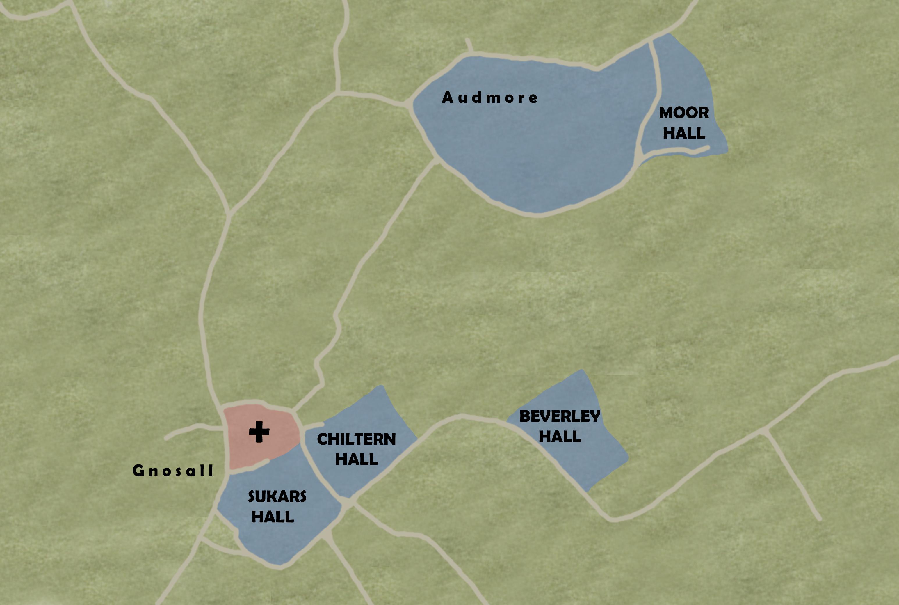
The clergy of Gnosall church were prebendaries. These were clergymen whose income came from a prebend, an area of land allocated to them. In Gnosall, there were four prebends: Andrews Hall (later Chiltern Hall); Beverley or Barley Hall; Morehall and Sukers Hall. The land was scattered around the open fields of the village. Gnosall was a prebendal manor, with a prebendal hall instead of a manor house.
Prebendaries were usually members of a cathedral chapter, so they did not have a parish church to provide them with an income. The Gnosall prebendaries were members of Lichfield Cathedral Chapter and they probably did not live in Gnosall,
appointing deputies to take services for them.
The Domesday Book (1086) says that there was more than one priest at Gnosall. This suggests that there was already a church. Some features of the present building may be of Anglo-Saxon origin, which makes it possible that Gnosall church was originally a minster. A minster was a church founded in Anglo-Saxon times (pre-1066) either by the King or a Bishop. It was a mother church that served an area than that normally served by a parish church.