Hill Deverill village, 1813
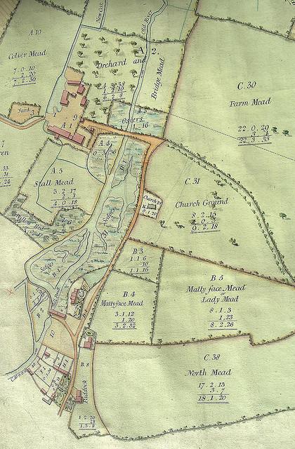
Detail from an estate map of 1813, created for the Duke of Somerset, the then lord of the manor. The map, drawn with north at the bottom, shows complex of buildings around Hill Deverill manor house near the top left of the image. The map was produced five years after a new tenant took occupation of the farm, following which a number of changes were made, including filling in fish ponds and pulling down several outhouses. At this time, the 16th-century Chantry Cottage - the remnant of an earlier manor house - had not yet been incorporated into its present L-shaped range of buildings.
The original map is part of the collections of the Wiltshire and Swindon Archives: 1332/L2.
Period:
Hanoverian (1714-1837)Copyright:
Alex CravenImage Caption:
Detail of an estate map, 1813