The Hampshire Downlands
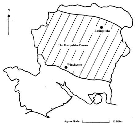
This map shows the east/west band of chalk downland in Hampshire. The area to the north is the Thames valley. The area to the south is the coastal strip that includes the New Forest. The area indicated by the hexagon is the approximate extent of the parishes selected for revision under the Victoria County History project.
The chalklands of Hampshire form a wide band roughly from east to west across the county. The Early Modern era saw a period of great prosperity in the county’s downlands, particularly during the late 16th and early 17th centuries. The country was recovering from the Black Death, the population was increasing sharply and inflation was causing a corresponding increase in food prices.
This prosperity was reflected in a surge of building in the rural parishes, where the evidence is still apparent today. Relatively affluent tenant farmers, both copyhold and freehold (for freehold was still a form of tenancy at that time), were eager to flaunt their wealth and built fairly expensive houses on their homesteads. Given the absence of stone, the traditional building materials in Hampshire were timber, wattle and daub and thatch, but the quality of the dwellings was such that they survive in large numbers.
Just as present-day house-owners extend and improve their homes, so, in the course of time, did the occupiers of timber-framed buildings. Many of Hampshire’s timber-framed houses have been surveyed, their building dates established (some dendrochronologically) and phases of alteration determined.