Copyright:
University of London/Camden Society
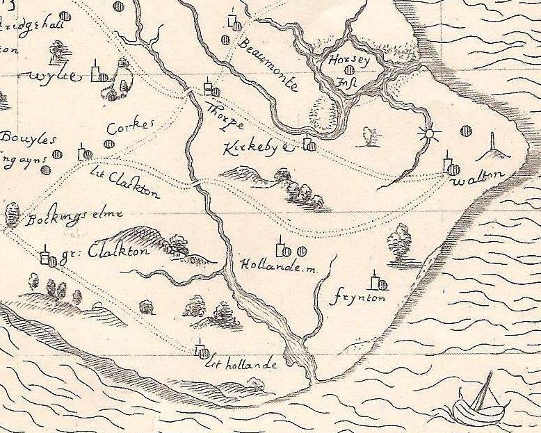
Image Caption:
The Gunfleet estuary on a map by John Norden (1594), showing its depth inland and the probable headlands at its mouth. First published by the Camden Society (1840).
Asset Author:
John Norden / Camden Society Norden / Clacton VCH Group