Paths and Tracks
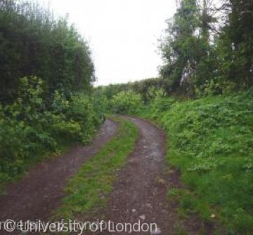 Dean Lane, Dunster, Somerset
There have been routeways across Britain since the land was reoccupied after the last ice age. Some long-distance routeways have proved long-lasting, particularly ones across well-draining land. But routes have more commonly been abandoned and replaced as a result of changing settlement patterns, economic activity, and political organisation.
Local networks can be reconstructed from the 13th century onwards, when documentary records begin to survive in abundance. But by then the types and patterns of routeways had already varied considerably between periods. Some distinctive types of routeways, particularly long-distance routes, can be associated with particular periods (e.g. Roman roads). But many routeways cannot be assigned, which makes the history of routeways a difficult area of study. Nonetheless, the periods of greatest change for long-distance routes are probably the Roman period and the 1950s to 1990s; and for local routes probably the mid to late Anglo-Saxon period (8th—10th centuries) and the era of parliamentary inclosure (approximately 1730s—1850s).
In the late palaeolithic and mesolithic periods (c. 10,000—c. 3,500 BC) human existence was based on constant movement as groups of gatherer-hunters moved repeatedly around established territories in search of edible plants and animals. Human patterns of movement are thought to have been influenced by the movement of animal herds between different terrains. The gathering-hunting way of life implies the existence of regularly used routes. But although some temporary camps have been discovered, no routeways have yet been identified. There must also have been long-distance routeways because tools were distributed across wide areas.
The succeeding neolithic period (c. 3,500—c. 2200 BC) must have seen a fundamental change in the pattern of routeways. The move to a life based on permanent settlements, grain cultivation, and domesticated livestock required the establishment of trackways between settlements and between settlements and agricultural resources. Trackways dating from the 3rd millennium BC, made of brushwood and later of planks, have been found in the Somerset levels. Long-distance trade continued, notably of axes. It is thought that the Icknield Way in East Anglia and the Pilgrims’ Way in Kent might date from this time. Other routeways must have led to the ‘causewayed camps’ and ‘temples’ (e.g. Stonehenge) of the neolithic period.
During the bronze and iron ages (respectively c. 2200—c. 800 BC, c. 800 BC—AD 43) settlement became more dense, and long-distance trade increased (e.g. in ores and metals). Evidence from cropmarks seen in aerial photographs suggests that by 500 BC there was a complex pattern of trackways. Many prehistoric local routes probably survived into the historical period, especially in western, south-western and south-eastern England where the landscape typically consisted of small enclosed fields and dispersed settlement, though this cannot be authenticated. Long-distance ridgeways are also thought to be of prehistoric origin. This may be correct, though again it cannot be demonstrated except perhaps in the case of the Great Ridgeway (Berks. and Wilts.), which runs close to numerous prehistoric monuments. The general density of prehistoric settlement suggests that there were also long-distance routes across lower ground, and in the iron age there must have been land routes to hillforts and ‘oppida’ (large settlements).
After the Roman invasion of AD 43 a new road system was superimposed across prehistoric routeways. For the first time, routes for long-distance communication were deliberately built across the countryside rather than created by use. Wherever possible Roman roads took a straight course between nodal points. They were plotted by professional surveyors and built by soldiers. Roman roads consisted typically of an embankment called an ‘agger’, which was covered by a stone surface and had adjacent ditches, though the quality of construction varied. The new roads enabled the Romans to conquer and occupy much of Britain, but they also facilitated administration and economic activity such as the marketing of produce and trade between towns. It is estimated that about 10,000 miles of roads were built. Many Roman roads have been traced by archaeologists, but some local routes remain to be discovered. The Romans also constructed bridges and fords.
In the early 5th century the Roman army and administration were withdrawn, coin imports ceased, and economic activity declined. Britain ceased to be part of the Roman world. Roman roads became dilapidated and many sections were abandoned, though historians have yet to study the process in detail. Travellers increasingly used a mixture of pre-Roman trackways, surviving sections of Roman roads, and new trackways created near abandoned Roman roads. The Germanic immigrants who settled in the 5th—7th centuries at first made extensive use of waterways. But by the 8th century new long-distance land routes were being created for economic purposes, sometimes incorporating existing local routes. The best known are saltways from Droitwich (Worcs.), along which salt was distributed across the west and south Midlands. In the 8th—10th centuries both local and long-distance routeways within a band through central England (from the north-east, through the Midlands to the south coast) were extensively reorganised alongside the formation of nucleated villages and large open fields. And in the late 9th and 10th centuries some long-distance routes became more important as burhs (fortified centres) were established in southern and then Midland England. The Anglo-Saxons used various terms for routeways. The commonest was weg (‘way’), while stræt (‘street’) referred to a constructed route, sometimes a surviving Roman road. Some routes were called herepæth (‘army-path’). The term ‘lane’ was later used for a route which passed between hedges.
The period from the 11th to the 17th centuries was essentially one of stability, a consequence of stability in settlement and landscape. In the 11th—13th centuries the quality of routes was improved by the widespread building of bridges; in the same period some routes were diverted into the market places of new towns. It is likely that the relative importance of routes altered as patterns of long-distance trade changed, and with technological developments. Alongside foot traffic (e.g. pack-horse trains), carts (with two wheels) became widespread from the late 12th century, and waggons (with four wheels) were introduced from the 1560s.
Robert Peberdy


