The Avill spillway looking south
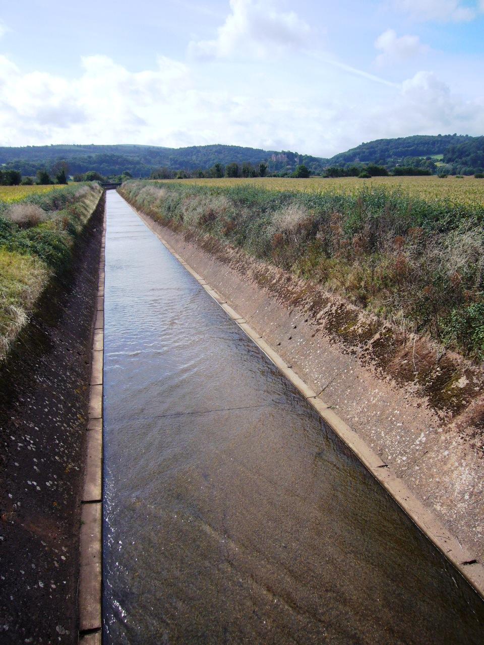
In 1964 a large concrete flood relief channel was constructed from Loxhole Bridge across Carhampton parish to the sea to protect Marsh from flooding. Most of the Avill's water is carried by this spillway except in very dry weather. Here its unnaturally straight course from Dunster can be seen.
Period:
Post World War II (1945-1999)Copyright:
University of LondonImage Caption:
Avill spillway looking south