Map showing the influence of geology on the settlement of Gnosall
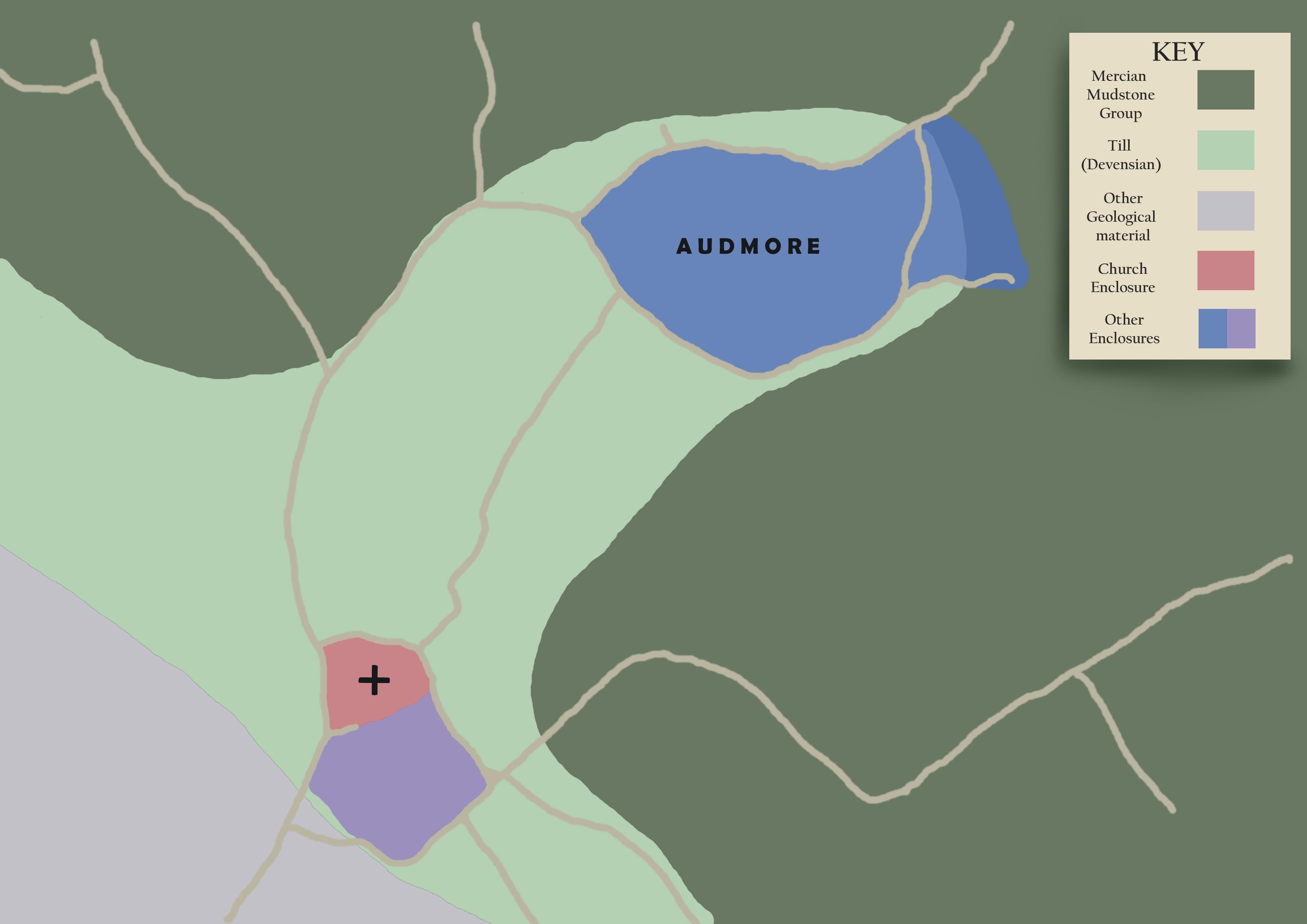
The village of Gnosall is situated close to a significant geological boundary. To the north and east lies an area of Mercian Mudstone that gives rise to the more fertile and easily worked soils, and is the most likely location for the medieval community’s arable fields. Closer to the village and extending to encompass Audmore is an area of Devensian Till giving rise to land that is moderately fertile, but seasonally wet and, therefore, better suited for pasturing animals.
The village itself is appropriately located on a well drained, but relatively infertile, site. The references to heath and moor in local place-names are indicative of rough grazing, while meadow land bordering the water courses to the west of village would have provided hay for the feeding of livestock.
Several local place-names incorporate the term leah, (e.g. Doley, Cowley, Knightley), which is thought to have meant woodland pasture, where trees were widely spaced and livestock, such as cattle, goats, sheep, pigs etc. were kept. Plardiwick, which is first recorded in 1199 AD, may also be associated with stock rearing, as it possibly incorporates the term heord(e)wic indicating a sheep farm.