Hill Deverill village, 1813
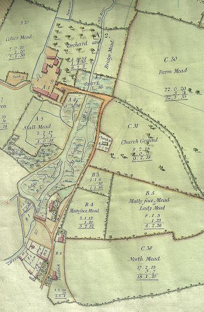
Detail from an estate map of Hill Deverill, from 1813. The map, drawn with north at the bottom, shows the old valley road running south along the west bank of the river Deverill as far as Hill Deverill manor house, beyond which it was necessary to use tracks alongside the river. The track on the west bank, a continuation of the road, is not shown on this map, and it is possible that it had fallen out of use at this time as a result of enclosure.
Note also that the old road lay further to the east than its present location, running between the parish church and the river.
The original map is part of the collections of the Wiltshire and Swindon Archives: 1332/L2.
Period:
Hanoverian (1714-1837)Copyright:
Alex CravenImage Caption:
Detail from a map of Hill Deverill, 1813.