River Barle
The Barle rises in the former Exmoor forest and now issues out of Pinkery or Pinkworthy Pond west of the Chains, the high moors in the centre of Exmoor. The pond is man-made, created by John Knight in the early 19th-century. By the time the river reaches the site of the medieval bridge at Simonsbath it has been joined by many tributaries issuing out of the narrow coombes which carve up the moors.
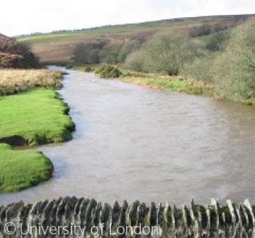
The river flows past the disused Wheal Eliza mine, around the ramparts of prehistoric Cow Castle and under medieval Lanacre bridge east into Withypool village. The valley narrows as the river turns south and the banks are increasingly wooded. After many twists and turns the river flows through Tarr Steps, a medieval clapper bridge, a popular tourist destination for at least two centuries.
The Barle continues to change direction many times, occasionally dividing into several channels, and then flows around and between the twin hillforts of Brewer and Mounsey Castles. There it meets its most important tributary, the Danes Brook, which marks the ancient boundary between Somerset and Devon.
Turning south again the Barle flows past Dulverton and under its ancient bridge, still the main entrance to the town. For centuries the river powered several mills, especially in Dulverton, and in the early 20th century it generated electricity.
The river runs between Brushford and Pixton Park before losing its identity as it joins the river Exe just north of Exebridge.
Content generated during research for the paperback book 'Exmoor: The making of an English Upland' (ISBN 13 : 978-1-86077-597-0 ) for the England's Past for Everyone series


