Dulverton housing
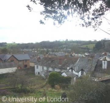
Roofscape of central Dulverton looking south-west to Battleton
The topography of Dulverton has constrained expansion of the town. The Barle river in its narrow steep-sided valley and the ridge of hills between the Barle and Exe rivers, particularly steep on the Dulverton side, left little room for building except on the south and south-east. Battleton was the first attempt at expanding the town's ground plan in the 18th century. Most 19th-century building took place in courts behind the town's streets or along the narrow verges of the upper part of Lady Street, now Northmoor Road. Here terraced cottages such as New Buildings are squeezed between the roadway and the almost vertical side of the valley, sometimes utilizing old quarry sites. Faced with clearing overcrowded poor cottages such as Castle Court, the 20th-century authorities laid out new streets in the gently sloping south-east between the town and Pixton Park. Flooding prevents building too close to the river. In the later 20th century much housing development has also been located at Brushford.
There are still a few houses in Dulverton dating from the late 16th or early 17th century including Sydenham Hall and later fine town houses like Bilbower House.
